
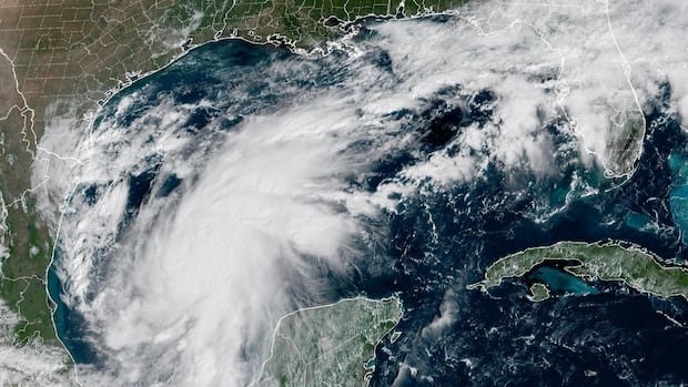
Tropical Storm Isaias has developed in the warm waters near eastern Mexico and is expected to intensify rapidly, potentially becoming the first hurricane of the Atlantic season before making landfall on the U.S. Gulf Coast later this week.
Communities in the storm’s projected path are making preparations for potential impact, with landfall anticipated by Friday evening. Precautionary measures include pausing production at some Gulf oil wells and canceling a popular weekend festival in an Alabama beach city, which typically attracts thousands of tourists. Florida’s governor has declared a state of emergency for over a third of the state’s counties.
There are concerns that Isaias could disrupt the upcoming college football showdown between long-time rivals Georgia and Alabama, an event that U.S. President Donald Trump is scheduled to attend. The storm is forecasted to potentially reach Category 3 hurricane status with winds of at least 178 km/h before hitting land, according to Michael Brennan, the director of the U.S. National Hurricane Center.
Brennan emphasized the potential for multiple dangerous and life-threatening impacts along parts of the northern Gulf Coast starting Friday and continuing into the weekend. Isaias is on track to possibly set a record as the latest initial hurricane of the Atlantic season, potentially surpassing a 121-year-old record.
This year’s Atlantic hurricane season has been notably quiet due to the influence of a strong El Niño, which has hindered storm formation in the region. Meanwhile, storm activity in the Pacific Ocean has been above average, with the formation of Tropical Storm Simon off the Mexican coast on the same day as Isaias.
The U.S. National Hurricane Center has issued a hurricane watch for the northern Gulf Coast from Bay St. Louis, Mississippi, to Indian Pass on the Florida Panhandle, indicating the possibility of hurricane conditions within the next 48 hours. Forecasters are warning of potential dangerous storm surge affecting a broad area from southeast Louisiana to Florida’s Big Bend, with heavy rainfall expected to trigger flash flooding near the coast and further inland.
Isaias is currently positioned approximately 365 kilometers northwest of Progreso, Mexico, and about 805 kilometers south-southwest of the mouth of the Mississippi River. With maximum sustained winds of 100 km/h, the storm is moving east-northeast at a speed of 13 km/h. The hurricane is projected to strengthen into a hurricane by Thursday as it veers northward toward the U.S. Gulf Coast, with a late Friday or early Saturday landfall anticipated.
The Gulf region has already begun to feel the effects of the approaching storm, as oil and gas producers have shut down a significant portion of offshore production, impacting nearly 15% of the U.S.’s annual crude oil output. The temporary halting of approximately 25% of oil production in the Gulf has removed around 511,000 barrels per day from the market, with eight manned oil platforms evacuated.
The potential disruption in oil markets due to the production cuts is a concern, especially if Isaias hits as a powerful storm near refineries. In addition to the economic impact, the storm has led to the cancellation of events such as the National Shrimp Festival in Gulf Shores, Alabama, and prompted emergency declarations in several Florida counties. Preparations are underway in areas expected to be affected, including power outage response plans and sandbag distributions to mitigate flooding risks.

